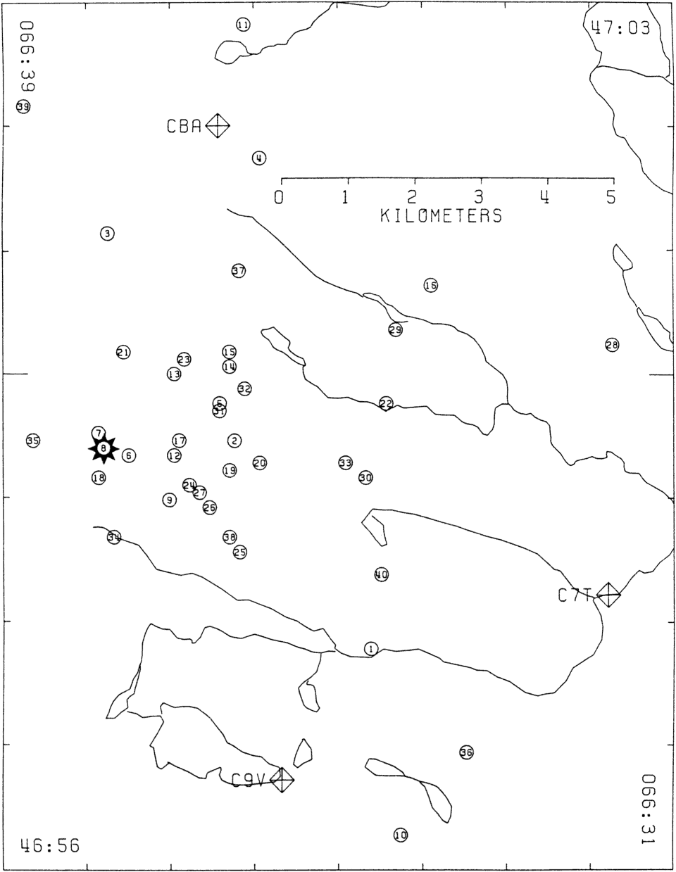
Figure 5.
Sketch map of the western portion of the study area showing
the locations of the forty aftershocks recorded.
The numbers in the circles correspond to the chronological list of aftershocks in
Table 4.
Starred-circle number 8 is the epicenter of the magnitude 3.5 aftershock.
Three digital stations are plotted while station C8T is omitted because it lies outside the eastern map boundary.