This page includes materials and information about trainings held by Dr. Mooney in the Indian Ocean Region,
Afghanistan and the Caribbean. The information
below includes all presentations, documents and lectures that contributed
to the sucess of the various trainings. Additional trainings continue to be held in the Indian Ocean region and will be available
online upon completion.
Preparing for the Next Tsunami:
Training in Seismology and Tsunami
Warnings in the Indian Ocean Region.
Introduction:
The December, 2004, Indian Ocean tsunami highlighted the need to increase capacity building
in the countries most severely affected by the international disaster. In response to this
need, the Indian Ocean Tsunami Warning System (IOTWS) Program, under the framework of the
UNESCO Intergovernmental Oceanographic Commission (IOC), was developed to create "tsunami
resilient" communities in the Indian Ocean region. The IOTWS has several components including
technical assistance, regional hazard detection, prediction, and warning formulation,
national dissemination and communication of warnings, local knowledge and preparedness to act,
and regional or sub-regional exchange of lessons learned and best practices.
A series
of training courses have been underway in the Indian Ocean region designed to improve
the understanding of earthquake seismology and tsunami warnings of staff employed in the
day-to-day running of the national tsunami warning systems. Learning is directed through
lecturers complemented with computer-based practical sessions. This training program in Seismology
and Tsunami Warning is an integral part of the IOTWS effort to provide technical assistance to
the region using "end-to-end" approach. This approach involves providing assistance in all stages
of hazard mitigation, from identifying earthquakes and tsunami to disseminating a warning to the
public. The particular focus of this course will be to provide a solid background in seismology,
relevant for developing a tsunami warning system. With this information, participants will, in
turn, be expected to educate other members of their community, or be actively engaged in tsunami warning
efforts.
The learning program of these courses is through a series of lectures and hands-on learning during
practical sessions. All lectures are copied to CD's available for distribution at the
end of the course. In addition, these handbooks contain information on the key aspects of the courses, and
are designated to provide supplemental material to the lectures.
Sponsoring Agencies:
 The U.S. Geological Survey provides support for seismic and tide station
technology transfer, regional and global interoperability through the IOC
framework, and capacity building at both the detection/warning formulation
and local preparedness levels. This is done at the data analysis and prediction
stage, as well as in hazard/vulnerability/risk mapping and modeling standards,
protocols, and methods. Training is one of the primary mandates of the USGS
effort.
The U.S. Geological Survey provides support for seismic and tide station
technology transfer, regional and global interoperability through the IOC
framework, and capacity building at both the detection/warning formulation
and local preparedness levels. This is done at the data analysis and prediction
stage, as well as in hazard/vulnerability/risk mapping and modeling standards,
protocols, and methods. Training is one of the primary mandates of the USGS
effort.
 The United Nations Educational, Scientific, and Cultural Organization
(UNESCO) functions as a laboratory of ideas and a standard-setter to forge
universal agreements on emerging issues. The Organization also serves as a
clearinghouse for the dissemination and sharing of information and knowledge
while helping Member States to build their human and institutional capacities
in diverse fields. UNESCO promotes international co-operation among its 191
Member States and six Associate Members in the fields of education, science,
culture, and communication.
The United Nations Educational, Scientific, and Cultural Organization
(UNESCO) functions as a laboratory of ideas and a standard-setter to forge
universal agreements on emerging issues. The Organization also serves as a
clearinghouse for the dissemination and sharing of information and knowledge
while helping Member States to build their human and institutional capacities
in diverse fields. UNESCO promotes international co-operation among its 191
Member States and six Associate Members in the fields of education, science,
culture, and communication.
 The Intergovernmental Oceanographic Commission (IOC) is a branch of
UNESCO that provides Member States of the United Nations with an essential
mechanism for global cooperation in the study of the ocean. The IOC assists
governments to address their individual and collective ocean and coastal
problems through the sharing of knowledge, information, and technology, and
through the coordination of national programs. Starting immediately after the
December 2004 Indian Ocean tsunami, the IOC has worked with countries to
develop regionally coordinated systems in the Indian Ocean, Caribbean and
north Atlantic and Mediterranean.
The Intergovernmental Oceanographic Commission (IOC) is a branch of
UNESCO that provides Member States of the United Nations with an essential
mechanism for global cooperation in the study of the ocean. The IOC assists
governments to address their individual and collective ocean and coastal
problems through the sharing of knowledge, information, and technology, and
through the coordination of national programs. Starting immediately after the
December 2004 Indian Ocean tsunami, the IOC has worked with countries to
develop regionally coordinated systems in the Indian Ocean, Caribbean and
north Atlantic and Mediterranean.
 The International Tsunami Information Center (ITIC) is hosted by the U.S.
National Oceanic and Atmospheric Administration for the IOC. Since 1965, the
Center's mission has been to mitigate the effects of tsunamis throughout the
Pacific. ITIC monitors and evaluates the performance and effectiveness of the
Pacific Tsunami Warning and Mitigation System. This effort helps countries to
establish or strengthen their national system by building capacities through
training and expert consultation for end-to-end tsunami warning and in tsunami
preparedness. Since 2004, it has supported the IOC�s efforts to develop a
global tsunami warning and mitigation.
The International Tsunami Information Center (ITIC) is hosted by the U.S.
National Oceanic and Atmospheric Administration for the IOC. Since 1965, the
Center's mission has been to mitigate the effects of tsunamis throughout the
Pacific. ITIC monitors and evaluates the performance and effectiveness of the
Pacific Tsunami Warning and Mitigation System. This effort helps countries to
establish or strengthen their national system by building capacities through
training and expert consultation for end-to-end tsunami warning and in tsunami
preparedness. Since 2004, it has supported the IOC�s efforts to develop a
global tsunami warning and mitigation.
 The U.S. Agency for International Development (USAID) provides
overall management, coordination, and administrative support for the
integrated U.S. program from its Regional Development Mission for
Asia, located in Bangkok, Thailand. USAID coordinates directly with appropriate USAID Mission
personnel and programs in India, Indonesia, and Sri Lanka, with the USAID Office of Foreign Disaster
Assistance (OFDA) offices in Bangkok and Kathmandu, and with USAID/Washington. USAID manages
the Program Integrator for the US IOTWS program, and works and coordinates directly with each of its
U.S. agency partners.
The U.S. Agency for International Development (USAID) provides
overall management, coordination, and administrative support for the
integrated U.S. program from its Regional Development Mission for
Asia, located in Bangkok, Thailand. USAID coordinates directly with appropriate USAID Mission
personnel and programs in India, Indonesia, and Sri Lanka, with the USAID Office of Foreign Disaster
Assistance (OFDA) offices in Bangkok and Kathmandu, and with USAID/Washington. USAID manages
the Program Integrator for the US IOTWS program, and works and coordinates directly with each of its
U.S. agency partners.
Workshops, Meetings and Trainings:
This area includes materials and information about trainings held by Dr. Mooney, his team and the
US IOTWS Program and related organizations. The materials are organized into files that include Presentations,
Fact Sheets, and Documents.
Trainings have been held in
Sri Lanka,
Thailand,
Indonesia,
Malaysia and the
Maldives.
- Sri Lanka Training Program in Seismology and Tsunami Warnings: 3 - 7 April, 2006

Day One: Introduction and the Tectonic Situation of Sri Lanka, Introduction to Earthquakes.
Download lecture 1: Introduction to Earthquake Science: A Historical Perspective
Download lecture 2: The Earth�s Structure and Seismicity
Download lecture 3: Seismotectonics of Southeast Asia
with special reference to Sri Lanka
Download lecture 4: Theoretical Seismology 1: Sources
Day Two: Seismic Theory and Applications.
Download lecture 5: Theoretical Seismology 2: Wave Propagation
Download lecture 6: Structure and Interpretation of Seismograms 1: Waveforms and Hypocentral Locations.
Download document: Seimic Waves and Earthquake Location
Download lecture 7: Structure and Interprestation of Seismograms 2: Magnitude and Source Mechanisms.
Download document: Earthquake magnitude, Intensity, Energy, Power Law Relations and Source Mechanism.
Download lecture 8: Review of the great Sumatra-Andaman Islands earthquake
Day Three: Global and Local Seismic networks, Instrumentation and Seismic data Analysis.
Download lecture 9: Forecasting Earthquakes
Download lecture 10: Instrumentation, Recording systems
Data transmission & Archiving
Download lecture 11: Global and Local Arrays
Download lecture 12: Damaging Effects of Earthquakes
Day Four: Earthquake Hazard Assessment and Conclusion of Seismology Training, Introduction to Tsunami.
Download lecture 13: Earthquake Hazard Assessment
Download lecture 14: Challenges in Observational Seismology in the Indian Ocean
Download lecture 15: Review of the Seismology component of the training course
Download lecture 16: Web Resources for Earthquake Information
Download lecture 17: Tsunami Generation
and Propagation
Day Five: Seismology, Tsunamis and Tsunamis Warnings in Sri Lanka, Summary, Discussion, Recommendations and Conclusions.
Download lecture 18: Developing a Global Tsunami Warning and Mitigation System:�From Commitment to Action
Download lecture 19: Status of Seismic Monitoring at the USGS National Earthquake Information Center
Download lecture 20: Indian Ocean Bathymetry
Download lecture 21: Management of the Organization for Sustainable Operation of the Tsunami Early Warning System
Download lecture 22: Interim Warning Procedures and the
Communication Plan for the Interim Tsunami Advisory Information Service
Download lecture 23: Structural Response to Tsunami Loading�
Download lecture 24: Hazard Reduction Strategy:
Warning Guidance
Download lecture 25: NDMO Case Study: HAWAII, USA. Emergency Response
and Tsunami Preparedness
Download lecture 26:
Ranet, Dissemination and Communication of Environmental Information
Download lecture 27: Three Basic Warning Needs
Download lecture 28: IOC Products and Services
Download lecture 29: Disaster Management Centre, Sri Lanka
Download lecture 30: Tsunami Early Warning System, Sri Lanka
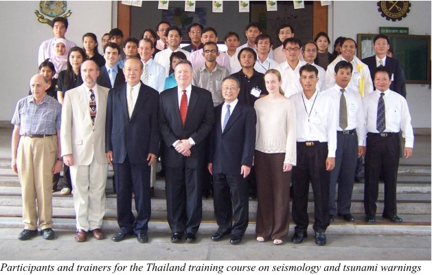
- Thailand Training Program in Seismology and Tsunami Warnings: 15 - 22 May, 2006
Download lecture 1: Introduction to Earthquake Science, Historical Perspective
Download lecture 2: Theoretical Seismology 1: Sources
Download lecture 3: Tsunami Response, Preparedness and Mitigation in Thailand
Download lecture 4: Seismic Waves and Earthquake Location
Download lecture 5: Theoretical Seismology 2: Wave Propagation
Download lecture 6: Seismiscity in Sumatra-Andaman, Seismic Belt during 1960-2005
Download lecture 7: Damaging Effects of Earthquakes
Download lecture 8: Global and Local Arrays
Download lecture 9: Instrumentation, Recording systems
Data transmission & Archiving
Download lecture 10: Active Fault Research in Thailand
Download lecture 11: Forecasting Earthquakes
Download lecture 12: Challenges in observational seismology with
special reference to the 2004 Sumatra-Andaman Islands earthquake
Download lecture 13: Web resources
Download lecture 14: Summary of seismology component of the course
Download lecture 15: Tsunami Warning Center Operations
(Local Tsunami)
Download lecture 16: Seismic and Sea Level Monitoring and Analysis Procedures
Download lecture 17: Guiding Principles of the
Richard H. Hagemeyer Pacific Tsunami Warning Center
Download lecture 18: Three Basic Warnings Needs
Download lecture 19: Data Processing for National Tsunami Warning Center in Japan
Download lecture 20: Numerical Modeling:
What, Why, and How
- Thailand Training Course in GPS, Advanced Seismology and Tsunami Warnings: 20 - 24 August, 2007
Download lecture 1: Geologic Hazards and Space Geodesy, part 1: Introduction
Download lecture 2: Geologic Hazards and Space Geodesy, part 2: GPS Specifics
Download lecture 3: Geologic Hazards and Space Geodesy, part 3: Geodetic Results from Sumatra
Download lecture 4: Geologic Hazards and Space Geodesy, part 4: Integrating GPS into Warning and Response
Download lecture 5: Tsunami: General Information
Download lecture 6: Earthquakes: General Information
Download lecture 7: Earthquakes: Detection, Location and Focal Geometry
Download lecture 8: Measuring Earthquake Size
Download lecture 9: Earthquake Scaling Laws
Download lecture 10: Modeling Earthquakes as Tsunami Sources
Download lecture 11: Landslide Tsunamis
Download lecture 12: Scientific Milestones from Historical
Tsunamis in the Pacific Ocean
Download lecture 13: Lessons from the 2004 Sumatra Disaster
Download lecture 14: The Indian Ocean Cases Studies and Scenarios
- Indonesia Training Program in Seismology and Tsunami Warnings: 8 - 17 May, 2006

Day One: Introduction to Earthquakes and the Tectonic Situation in Indonesia.
Download lecture 1: History of Seismology
Download lecture 2: Theorical Seismology 1 :
Media and Seismic Tomography
Download lecture 3: The Earth�s Structure and Seismicity
Download lecture 4: Sources of Tsunami
Download lecture 5: Overview of the U.S. Indian Ocean Tsunami Warning System (IOTWS) Program
Day Two: Seismic Theory and Applications
Download lecture 6: Earthquakes Around the World
Download lecture 7: Theoretical Seismology: Wave Propagation
Download lecture 8: Seismic Waves and Earthquake Location
Download lecture 9: Damaging Effects of Earthquakes
Download lecture 10: The Discovery of the Earth:�The Quest to Understand the Interior of our Planet
Day Three: Global and Local Seismic networks, Instrumentation and Seismic Data Analysis.
Download lecture 11: Earthquake Magnitude, Intensity, Energy,
Power Law Relations and Source Mechanism
Download lecture 12: Instrumentation, Recording systems
Data transmission & Archiving
Download lecture 13: Global and Local Arrays
Download lecture 14: Forecasting Earthquakes
Day Four, Five and Six: IRIS Instrumentation Training, Portable Broadband Seismology.
Download lecture 15: Introduction
Download lecture 16: Functions of an Instrument Center
Download lecture 17: Data Acquisition System Overview
Download lecture 18: Seismometer Overview
Download lecture 19: Communication Options
Download lecture 20: Power Systems
Download lecture 21: Seismic Vaults for Temporary
Installations
Download lecture 22: Best Field Practices
Download lecture 23: Sensor Quality Control

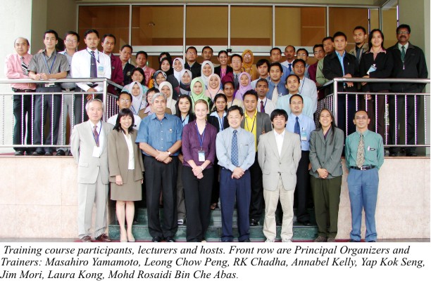
- Malaysia Training Program in Seismology and Tsunami Warnings: 21 - 25 August, 2006
Download lecture 1: The Plate Tectonics and Seismicity
Download lecture 2: Theoretical Seismology 1: Sources
Download lecture 3: Theoretical Seismology 2: Wave Propagation
Download lecture 4: Forecasting Earthquakes
Download lecture 5: Earthquake Location
Download lecture 6: Focal Mechanism Solutions
Download lecture 7: Damaging Effects of Earthquakes
Download lecture 8: Global and Local Arrays
Download lecture 9: Tsunami Science: Sources, Generation, Propagation, Flooding�
Download lecture 10: Instrumentation, Recording systems
Data transmission & Archiving
Download lecture 11: IOC Capacity Building: TsunamiTeacher 1
Download lecture 12: IOC Capacity Building: TsunamiTeacher 2
Download lecture 13: Tsunami Warning Center Operations
(Local Tsunami)
Download lecture 14: Interim Provision of Tsunami Watch Information for the Indian Ocean Countries
Download lecture 15: Table-Top Exercise: Indian Ocean Scenario
Indonesia Source
Download lecture 16: Northwest Pacific Tsunami Advisory Center
Download lecture 17: Early Warning Systems Tsunami Warning Centers Case Study: South China Sea
Download lecture 18: Why is a Tsunami a Hazard?
Download lecture 19: Numerical Modelling:
What, Why, and How
Download lecture 20: Hazard Reduction Strategy:
Assessment
Download lecture 21: NDMO Case Study: Hawaii, USA Emergency Response and Tsunami Preparedness
- Maldives Training Program in Seismology and Tsunami Warnings: 27 - 31 August, 2006
Download document 1: Tsunami Observations: Variations in Tsunami Arrivals at Coastal Sea Level (tide) Stations
Download document 2: Guarding Against Tsunamis: The Challenges of Building Preparedness at the National and Local Levels
Download document 3: Numerical Modeling:
What, Why, and How
Download document 4: USA Efforts: Consideration of the Requirements for Vertical Evacuation:
Engineering Design and Construction Guidance
Download document 5: Surviving a Tsunami�Lessons from Chile, Hawaii, and Japan
Download document 6: IOTWS Communications Plan
Alert, Earthquake Sea Level display/stations Tsunami event data
Download lecture 1: Hazard Reduction Strategy:
Assessment
Download lecture 2: Exercise: Indian Ocean Scenario Indonesia Source
Download lecture 3: Exercise: Indian Ocean Scenario Makran Source
Download lecture 4: Japan Tsunami Warning and Mitigation System Preparedness
Download lecture 5: The Plate Tectonics and Seismicity
Download lecture 6: Interim Provision of Tsunami Watch Information for the Indian Ocean Countries
Download lecture 7: RANET, Dissemination and Communication of Environmental Information for Rural and Remote Community Development
Download lecture 8: Tsunami Science: Sources, Generation, Propagation, Flooding
Download lecture 9: Why is a Tsunami a Hazard?
Download lecture 10: IOC Capacity Building:
Download lecture 11: NDMO Case Study: Hawaii, USA Emergency Response and Tsunami Preparedness
Download lecture 12: Theoretical Seismology 1: Sources
Download lecture 13: Damaging Effects of Earthquakes
Download lecture 14: Theoretical Seismology 2: Wave Propagation
Download lecture 15: Tsunami and Earthquakes in Maldives
Download lecture 16: Focal Mechanism Solutions
Download lecture 17: Earthquake Location
Download lecture 18: Instrumentation, Recording systems
Data transmission & Archiving
Download lecture 19: Global and Local Arrays
Download lecture 20: The 2004 Sumatra-Andaman Islands earthquake
Download lecture 21: Forecasting Earthquakes
Afghanistan Training Courses.
Afghanistan is located in a tectonically active region where ongoing deformation has generated
rugged mountainous terrain, and where large earthquakes occur frequently. These earthquakes can
cause damage, not only from strong ground shaking and surface rupture, but also from liquefaction
and from extensive land sliding. The Magnitude 6.1 earthquake of March 25, 2002 highlighted the
vulnerability of communities to such hazard and resulted on over 1000 fatalities.
-
Afghanistan Training Course in Modern Earthquake Hazard Assessments:
This training course in Modern Earthquake Hazard Assessments is an integral part of the international effort
to provide technical assistance to Afghanistan using an "end-to-end" approach. This approach
involves providing assistance in all stages of hazards assessment, from identifying eartquakes,
to disseminating information on mitigation strategies to the public. The particular focus of this
course is to provide a solid background in the relevant seismological and geological method
relevant for preparing for future earthquakes. With this information, participants are, in turn,
expected to educate other members of the Afghan community, or be actively involved in
earthquake hazard assessments.
The training course was held at the Afghan Geological Survey headquarters in kabul between
the dates of 2-6 December 2006. The learning format of the course was through a series of
Powerpoint lectures given by four U.S.G.S. specialists in Earthquake Science, and subsequent
conversations and debate involving participation from all present. Lectures were presented in
English with simultaneous translation into Dari. The Powerpoint lectures are mostly annotated
in both English and Dari. Please note that the order of lectures presented is not the same as the
actual running order used during training in Kabul
Download
lecture 1: The Discovery of the Earth
Download
lecture 2: Plate Tectonics
Download
lecture 3: Earth Structure and Seismicity
Download
lecture 4: Regional Tectonics: Evolution of Tethys
Download
lecture 5: Stress, Strain, and Faulting
Download
lecture 6: Earthquake Sources, Magnitude, and Focal Mechanisms
Download
lecture 7: Seismology: Wave Propagation
Download
lecture 8: Global and Local Arrays
Download
lecture 9: Damaging Effects of Earthquakes
Download
lecture 10: Earthquake Microzonation
Download
lecture 11: Hazard Mapping
Download
lecture 12: Risk Assessment
Download
lecture 13: Fault Zone geology and Paleoseismology
Download
lecture 14: Earthquake Strong Ground Motion
Download
lecture 15: Predicting Ground Motion from Earthquakes
Download
lecture 16: Earthquake Hazard Prediction and forecasting
Download
lecture 17: Risk Mitigation Strategies
Download
lecture 18: Post-Earthquake Response
Download
extra lecture: Instrumentation, Recording Systems, Data Transmission & Archiving
Download
extra lecture: Web resources
-
Afghanistan Training Course in Modern Concepts in Earth Science and Resource Assessments:
Natural Resources area a key component of the economic and social well being of a country. For
more than 2,000 years, Afghanistan has been famous for its precious gemstones. In addition,
the country has world-class iron and copper deposits, abundant coal, oil and gas, and
outstanding water resources. It is also a country with unparalleled natural beauty and
highly varied scenery, which have attracted visitors from all over the world.
For these reasons, Afghanistan's rich natural resources have long been the envy of countries
worldwide. However, more than 25 years of conflict has largely destroyed the national organizations,
such as the Geological Survey, which are responsible for identifying and developing Afghanistan's
natural resources. These armed conflicts have compromised the national government's capacity
to function for the public good, and to contribute to the economic growth of the country. In
addition, scientific facilities, laboratories, equipment, and logictic support have largely disappeared.
Despite the return of many employees to the Ministry of Mines and Industry (after many years of absence),
this organization faces great challenges due to a lack of adequate facilities and funding. Moreover,
many of the employees have missed the recent developments within their scientific and technical disciplines.
For all practical purposes, Afghanistan is starting all over again in the development of its rich natural
resources.
This training course in "Modern Concepts in Earth Science and Resource Assessments" aims to provide
the staff of the Afghan Geological Survey with a broad overview of current geologic concepts
and practices in natural resource assessment. The learning format of the course is through a series
of lectures using Powerpoint images. Lectures are presented in English with simultaneous translation
into Dari. USGS fact sheets produced to summarize the recent coal and petroleum resource
assessment were also included in the training course. The USGS is collaborating with the Afghanistan
Ministry of Mines and Industries on a large number of projects. Products and more information
on theses projects are available for download and viewing on the website:
http://afghanistan.cr.usgs.gov/
Download
introduction: What is Resource Assessment?
Download
lecture 1: Plate tectonics
Download
lecture 2: Timing and the Geologic Record
Download
lecture 3: Geology of Afghanistan and the Greater Region
Download
lecture 4: Weathering, Erosion and Mass Wasting
Download
lecture 5: Sedimentation
Download
lecture 6: Metamorphism
Download
lecture 7: Igneous Rocks
Download
lecture 8: Volcanoes, Island Arcs and Geothermal Systems
Download
lecture 9: Deformation
Download
lecture 10: Groundwater Resources and the Hydrological Cycle
Download
lecture 11: Oil and Gas Resources
Download
lecture 12: Coal Resources
Download
lecture 13: Mineral Resources
Download
USGS fact sheet: Assessing the Coal Resources of Afghanistan
Download
USGS fact sheet: Assessment of Undiscovered Petroleum Resources of Northern Afghanistan, 2006
Caribbean Training Program in Seismology and Tsunami Warnings.
To prevent loss of life and destruction of property, and mitigate against catastrophic
economic impacts, the people of the Caribbean region have an immediate need for a
Coastal Hazards Warning System linked to the soon-to-be-established Global Earth
Observation System of Systems (GEOSS). The primary purpose of the system will be to provide
timely and accurate forecasts and warnings of coastal flooding and associated hazards due
to tsunami, storm surge and hurricanes.
Considering conclusions reached at the World Conference on Disaster Reduction
(Kobe, Japan, 19�22 January 2005) and UNESCO/IOC call to establish a Global Tsunami
Warning System within the Global System of Systems (Ref. UNESCO DG speech
31.01.2005, Ministerial Meeting on Regional Cooperation on Tsunami Early Warning
Arrangements, Phuket, Thailand), the UNESCO�s Intergovernmental Oceanographic Commission
(IOC) through its IOCARIBE-Sub-Commission and jointly with UN-ISDR, WMO and
UNEP CAR-CU organized the "International Conference for the Development of a
Tsunami and Coastal Hazards Warning System for the Caribbean Sea and Adjacent Regions"
in Mexico City, Mexico, from 1 to 3 June 2005. In line with the recommendations of the
Communiqu� adopted at this international conference, the 23rd session of the UNESCO/IOC
Assembly adopted IOC Resolution XXIII-13, by which it decided to establish an
Intergovernmental Coordination Group (ICG) for the Tsunami and Other Coastal Hazards Warning
System for the Caribbean and Adjacent Regions.
This training program in Seismology and Tsunami Warning is an integral part of the effort
to provide technical assistance to the region using an "end-to-end" approach. This approach
involves providing assistance in all stages of hazard mitigation, from identifying
earthquakes and tsunamis to disseminating a warning to the public. The particular focus
of this course is to provide a solid background in seismology, relevant for developing
a tsunami warning system. With this information, participants are, in turn, expected to
educate other members of the community, or be actively engaged in tsunami warning system
efforts.

- Day One: Introduction to Seismology:
Download lecture 1: Seismicity and Plate Tectonics
Download lecture 2: Tectonics of the Caribbean
Download lecture 3: Seismic Waves
Download lecture 4: Earthquake Sources and Magnitude
- Day two: Introduction to Seismology:
Download lecture 5: Seismic Monitoring in the Caribbean
Download lecture 6: Earthquake Focal Mechanisms
Download lecture 7: Damaging Effects of Earthquakes
Download lecture 8: Seismic Instrumentation
Download lecture 9: Earthquake Location
- Day Three: Tsunami Warning and Mitigation Systems - Science, Preparedness and Hazard Risk Assessment:
Download lecture 10: Basic Characteristics of Tsunamis
Download lecture 11: History of Caribbean Tsunamis
Download lecture 12: People-Centered Tsunami Early Warning Systems
Download lecture 13: Hazard Mitigation in the Caribbean
Download lecture 14: Tsunamis in the Caribbean
Download lecture 15: Tsunamis Early Warning and Mitigation Systems: Hazard Risk Assessment
Download lecture 16: Possible Methods for Estimating the Potential of Tsunami
Earthquakes and Earthquake-induced Landslide Tsunami
Download lecture 17: UNESCO/IOC Core Staff for IOTWS and Global Tsunami
- Day Four: Tsunami Warning and Mitigation Systems - Tsunami Warnings
Download lecture 18: Numerical Modelling: What, Why, and How
Download lecture 19: Tsunami Warning Center Operations: Caribbean Simulations
Download lecture 20: Sea Level Monitoring for Tsunami Confirmation and Forecast
Download lecture 21: Tsunami Mitigation: Preparedness, Resilience and Outreach. Puerto Rico Case Study
Download lecture 22: A Risk-to-Life Assessment: The Very High Caribbean Risk
Download lecture 23: Tsunami Warning Center Operations (Local Tsunami)
Download lecture 24: Effective and Reliable
End-to-End Tsunami Warning Systems: TWC Standard Operating Procedures
- Day Five: Tsunami Warning and Mitigation Systems - Emergency Response for Tsunamis and Other Hazards
Download lecture 25: Sea Level Monitoring in the Caribbean
Download lecture 26: TWC Operations for the Caribbean
Download lecture 27: Effective and Reliable End-to-End Tsunami Warning Systems: Tsunami Emergency
Response SOP
Download lecture 28: TWC Alerting: Message Content and Dissemination
Download lecture 29: Tsunami and the Media: Broadcasting Alerts and Public Safety - Japan NHK
- Day Six: Tsunami Warning and Mitigation Systems - Communications Tests and Exercices
Download lecture 30: Warning Dissemination and Public Alerts: GTS / AFTN, EMWIN, and Other Reliable Methods
Download lecture 31: Effective and Reliable End-to-End TWS: Regional and National Exercises and
Post-Exercise Evaluations
Download lecture 32: A Pacific-wide Tsunami Warning and Communication Exercise New Zealand
Exercise Observations
Back to main page